
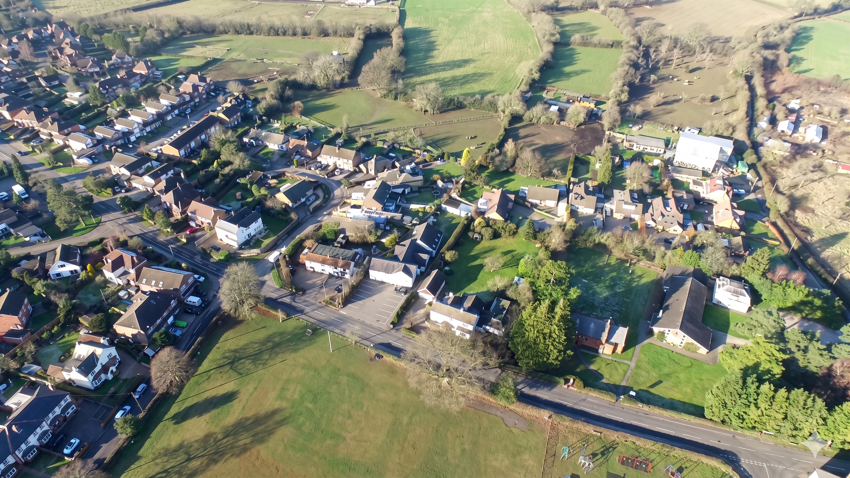
Holmer Green, Buckinghamshire
Completed strategic land project positioned within the Metropolitan Green Belt near High Wycombe
Overview
Holmer Green is an affluent village location within Chiltern District, Buckinghamshire, positioned 3.5 miles from the M40, 7 miles from the M25, and 25 miles from Central London. The site benefited from excellent connectivity to London Heathrow Airport (15 miles) and High Wycombe railway station (3 miles, offering 50-minute services to London Marylebone).
Holmer Green is situated within the Chiltern District, a highly affluent area within the Metropolitan Green Belt known for exceptional quality of life and residential desirability.
The village adjoins Hazlemere and forms part of the wider High Wycombe conurbation, benefiting from established infrastructure and community amenities.
Chiltern District encompasses 196 square kilometres of the Metropolitan Green Belt and is recognised for its high property values, rural character, and proximity to London. The area combines countryside preservation with excellent connectivity to central London, major airports, and motorway networks. High Wycombe, the principal town, offers comprehensive commercial and transport facilities.
Location Overview
The Holmer Green site represented a strategic land opportunity within Chiltern District, an area covering 196 square kilometres of the Metropolitan Green Belt.
The location was characterised by high property values, quality of life indicators, and proximity to major transport infrastructure including the M40 and M25 motorways.
This site was identified and positioned based on its connectivity advantages and the broader planning policy landscape affecting the Chiltern and South Bucks area.
All plots were conveyed on a freehold basis with ownership registered through the UK Land Registry via independent UK solicitors.
Site Details
Key Distance Highlights
3.5 miles to M40 motorway
7 miles to M25 motorway
25 miles from Central London
15 miles to London Heathrow Airport
3 miles to High Wycombe Mainline Station (50 mins to London Marylebone)
Strategic Project Overview
The Holmer Green site was positioned within Chiltern District, a highly affluent area of the Metropolitan Green Belt characterised by high property values, rural character, and exceptional quality of life. The site benefited from its direct access to the A404 (Amersham Road), a major route connecting to the M40 and M25 motorways.
This location offered strategic advantages due to its proximity to Central London (25 miles), London Heathrow Airport (15 miles), and High Wycombe mainline railway station (3 miles, with 50-minute services to London Marylebone). The site was promoted during a period of significant planning policy development, including the adoption of the Wycombe Local Plan in August 2019, which validated the strategic importance of this area.
Site Specifications
| Location | Holmer Green, Buckinghamshire |
| Tenure | 100% Freehold |
| Access | A404 / M40 / M25 |
| Status | Project Completed |
Strategic Valuation Note
This site benefits from its position within the Metropolitan Green Belt, situated just 25 miles from Central London and 15 miles from Heathrow Airport. The 2019 Local Plan adoption successfully re-established this area as a prime location for future development potential.
Regional Highlights
The site is located within Chiltern District, an area renowned for its historic estates, architectural heritage, and protected natural landscapes.

The historic country estate of Prime Minister Benjamin Disraeli, offering stunning Victorian architecture and gardens.

A world-renowned Palladian villa and 45-acre landscaped estate, iconic for its classical temples and historical significance.

A protected Area of Outstanding Natural Beauty (AONB), offering vast rolling landscapes and premier walking trails.
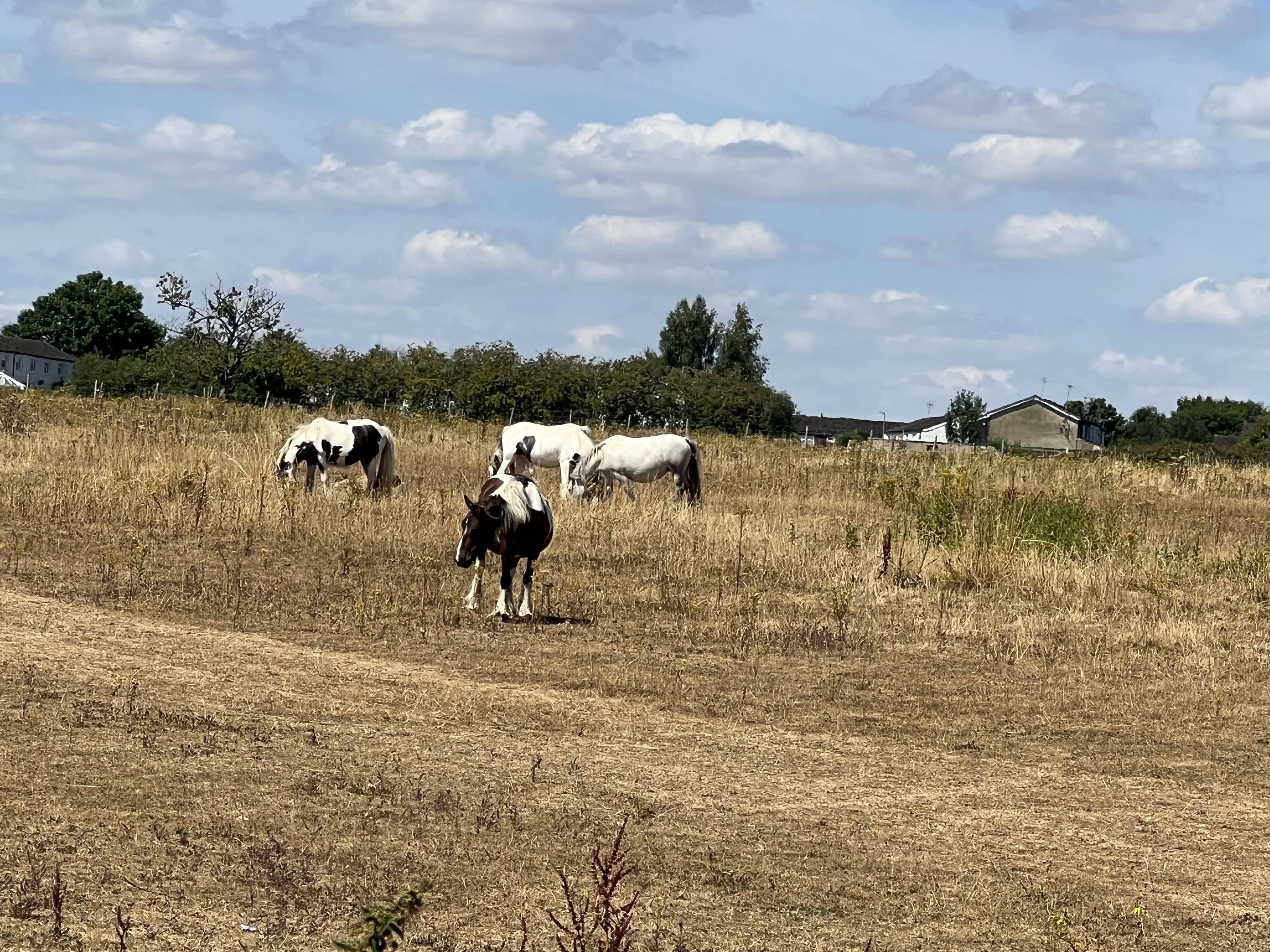
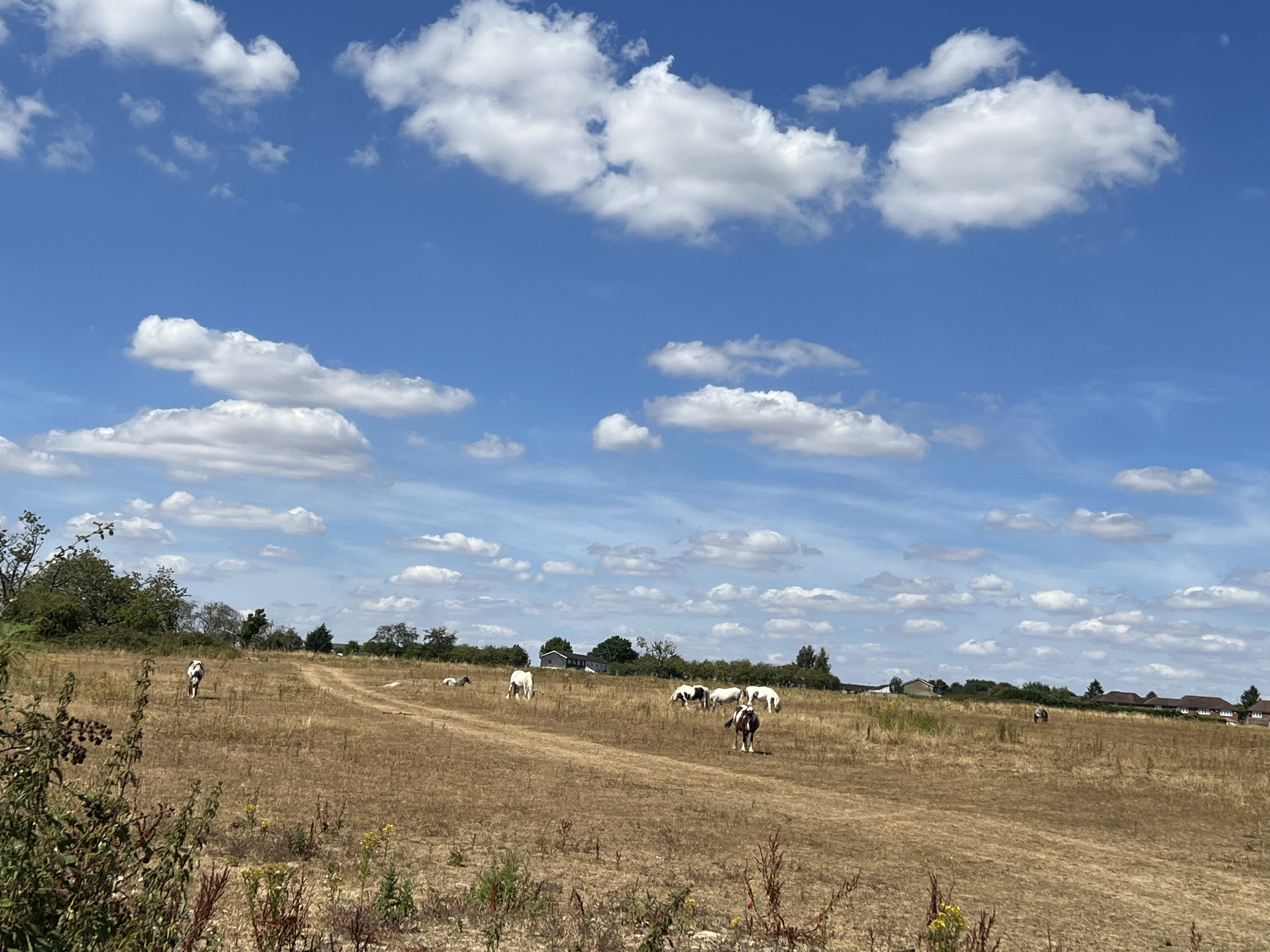
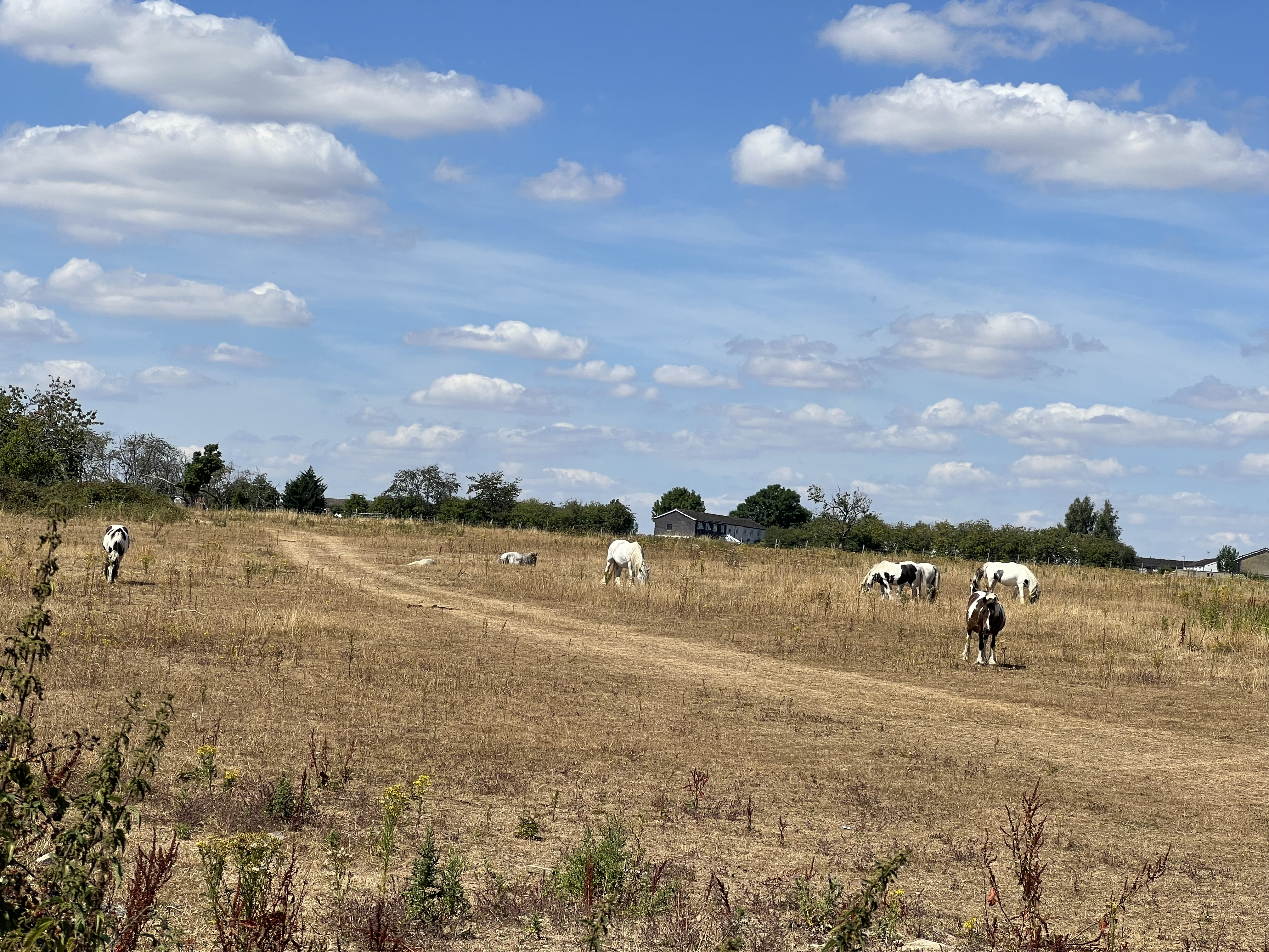
Site Views
Visual overview of the land site and surrounding area.
Location on the Map
Explore the site and surrounding area using Google Maps, or open the full interactive Street View in a new tab.
Accessibility & Surroundings
The site benefits from access to major road networks, nearby rail services, and proximity to established residential areas, making it a well-connected long-term land holding location.
- Direct access via A404 (Amersham Road)
- Short distance to M40 motorway junction
- Proximity to M25 orbital motorway
- Regular rail services to London Marylebone
- Close to London Heathrow Airport
Planning Status
Current Status: This was a completed project. The site was promoted during a period of significant planning policy development in the Chiltern and South Bucks area. Wycombe District Council adopted their Local Plan in August 2019, which removed certain nearby sites from Green Belt designation, demonstrating that the area was considered suitable and sustainable for growth. The site was positioned to planning authorities based on these evolving policy frameworks and excellent accessibility credentials.
The site is considered strategic land due to its location and surrounding development context.
Planning Framework Updates
Factual updates regarding local planning framework developments related to this site.
Wycombe Local Plan Adoption - Historical Context
August 2019
In August 2019, Wycombe District Council formally adopted their Local Plan following extensive consultation and examination processes.
The adopted plan removed certain sites adjacent to this location from Green Belt designation, recognising the area's sustainability and suitability for development.
This Local Plan adoption provided significant validation of the strategic positioning rationale for land in this locality.
The site was promoted to both Wycombe District Council and Chiltern & South Bucks District Council based on excellent accessibility via the A404, proximity to the M40 and M25, and strong connectivity to London and Heathrow.
Among adjacent land parcels being promoted in the area, this site was identified as offering superior access credentials and strategic advantages.
This information reflects historical planning policy developments and does not constitute current planning advice.
The adoption of the Wycombe Local Plan and Green Belt boundary changes related to other sites and did not guarantee planning permission for this specific site.
Planning outcomes remained uncertain and subject to local authority discretion throughout the project lifecycle.
Ownership & Legal Structure
All plots were sold on a freehold basis with ownership registered in the buyer's name via the UK Land Registry. All transactions were completed through independent UK solicitors following standard conveyancing processes.
After-Sales & Planning Support
Greenland Properties provides post-completion support including coordination with planning consultants, monitoring of local planning frameworks, and general landowner updates where applicable.
No planning outcomes are guaranteed.
All information provided is for general informational purposes only and does not constitute investment advice.
Land values may fluctuate and planning outcomes are not guaranteed. Buyers are encouraged to seek independent legal and financial advice.